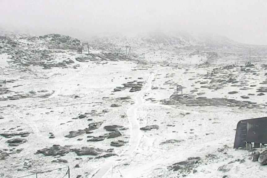
Snow reached Thredbo as a NSW cold front drove temperatures down by more than 15C in parts of Sydney and brought rain and storms.
A late-season cold snap
A sharp spring temperature swing brought snow to parts of New South Wales, with Thredbo falling to -5C overnight and some Sydney suburbs losing more than 15 degrees in a matter of hours. The cold arrived only weeks before summer, after a warm winter had set expectations for milder conditions. That contrast helps explain why the change felt so abrupt: the forecast temperature alone tells only part of the story when people have spent the preceding days in warmth.
David Crock, a senior meteorologist at the Bureau of Meteorology, described November as a “very volatile time of year.” He said the cold front wasn’t especially unusual, though it stands out when it arrives. Spring weather can shift quickly as different air masses move across the region, and a familiar weather pattern can still produce a striking local change.
Snow fell at elevations as low as 400 to 500 metres in parts of Tasmania, while the Alps in Victoria and NSW received snow down to about 800 metres, Crock said. Thredbo was still seeing snowfall on Sunday morning, when the temperature was around 0C. The spread in elevation matters: snowfall at lower levels makes the event more noticeable beyond the highest mountain areas, even when the broader cause is a passing cold front.
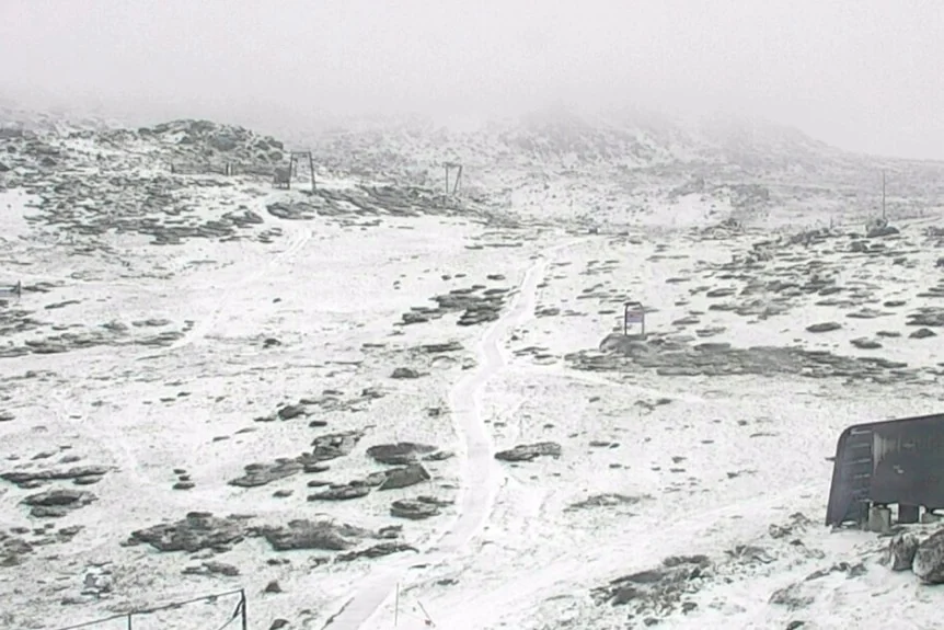
Thredbo dropped to -5.0 degrees Celsius overnight. (Supplied)
A steep fall after Saturday’s warmth
The cold air pushed into NSW as strong fronts formed between heat over northern Australia and colder ocean conditions to the south, Crock said. That temperature gap helped drive cold air north through the state and into southern Queensland. The pattern gives a useful explanation for the sudden change: warm conditions in one part of the country can sit alongside much colder air farther south, and a front can carry that colder air into places that had been warm.
The change was stark across western Sydney. Penrith reached 31.5C at 3pm on Saturday before dropping to 14C later that evening. Parramatta fell from 30.4C to 13C overnight. Sydney’s maximum was 29.7C shortly after lunch, with the temperature down to 14C by evening. Those readings show how quickly the conditions changed, rather than a gradual cooling spread over several days.
For residents, a fast drop can make the day feel divided into two different seasons. Clothing, outdoor plans and expectations set in the afternoon may no longer suit the evening. If you’re working in this space, the practical challenge is communicating that timing clearly: a daily high can obscure how cold conditions may become later the same day.
The front also brought heavy rain and storms. On Sunday, temperatures across NSW were generally between 10C and 12C. That combination of rain, wind and lower temperatures can make conditions feel more severe than the thermometer alone suggests, though the reported figures don’t establish how each location was affected.
Snow catches Thredbo by surprise
For Thredbo resident Madeleine McVie, the snowfall was welcome but unexpected after a warm winter. There was enough snow to build a snowman, though the cold made getting up difficult. Her account puts a domestic scale on the weather: the same snowfall that draws attention as a seasonal event also means a cold morning for people who live through it.
“It certainly was hard to get out of bed. It is very cold down here,” she said. After a little snow a few days earlier, heavier flakes began falling around 4pm on Saturday. “I looked out the window and it was dumping down big fat flakes.” The change from a light dusting to heavier snowfall would have made the arrival more dramatic, especially after a winter that had felt warm.
Hikers at Mount Kosciuszko were excited by the snowfall, McVie said. Locals were preparing for the mountain biking season and hadn’t expected snow in November either. That mismatch between the weather and the activities people had in mind is part of what makes a late cold snap memorable. And this is the part most people overlook: the same conditions can be a welcome spectacle for visitors and a disruption to plans for residents.
What the episode signals for spring
Strong southerly winds and hazardous coastal conditions were forecast for Monday, with cool weather expected to persist. Those warnings extend the story beyond the snowfall itself. A cold front can affect travel and outdoor activity through wind and coastal conditions, even in places that see no snow. The forecast suggests people needed to account for the continuing change, rather than treating Saturday’s temperature drop as a brief curiosity.
This is more significant than it looks as a reminder of how misleading a season’s broad label can be. A warm winter doesn’t prevent a sharp cold snap in spring, and a late-season burst of snow doesn’t by itself establish a lasting shift in conditions. The reported temperatures and snowfall describe a pronounced episode; Crock’s account frames the front as within the range of November volatility.
That said, the contrast between Saturday’s warmth and Sunday’s cold is the clearest measure of the event’s impact. Spring warmth in NSW can give way quickly when a strong southern front moves through. For anyone making plans around the weather, the useful lesson is modest but practical: conditions can change within hours, and the local forecast matters more than assumptions based on the week or season.
Discussion
Sign in to join the discussion.